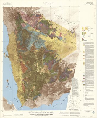
"Base map prepared by the U.S. Geological Survey from NASA Land Satellite imagery, Landsat-1 multispectral band 7 and miscellaneous source maps of the Yemen Arab Republic."
"Geologic interpretation field checked in June and July 1975 by M.J. Grolier, W.C. Overstreet, Mohammed Mukred Ibrahim, and G.C. Tibbetts, Jr. and in February 1976 by M.J. Grolier."
"1978 A.D. [equals] 1398 A.H."
Includes Landsat image sheet index and notes.
"G78581."
Includes bibliographical references.
Date:
1978
Attribution:
Print map scanned from Olin Library Map Collection
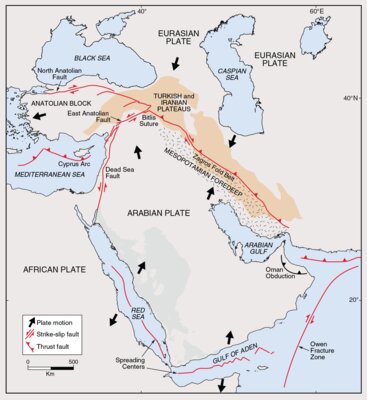
Fig. 1 from Geo-Information Systems for the Middle EastGeoArabia, Vol. 5, No. 2, 2000 Gulf PetroLink, Bahrain Design and Development of Information Systems for the Geosciences: An Application to the Middle East