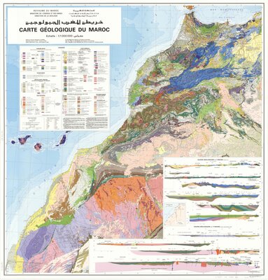
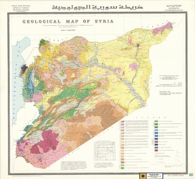
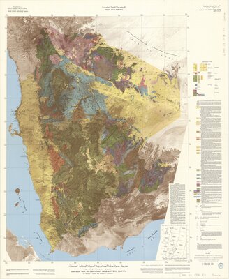
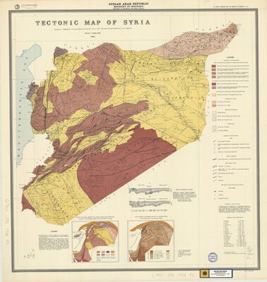
Geology Features
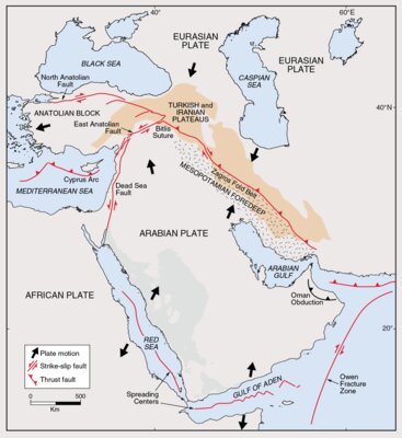
Tectonic Units of the Middle East
The major geologic features of the region, the major fault structures of the Jordan Valley, the Gulf of Aqaba and the Red Sea, owe their location and evolution to movements of the Arabian and African plates. The Arabian plate was part of the African plate. About thirty million years ago Arabia started to separate from the rest of Africa, and the Red Sea was created by seafloor spreading. Arabia moved northward faster than Africa and the Dead Sea fault system was developed, and Arabia collided with Turkey and Iran to form the mountain belts of Taurus and Zagros.
Selections Representing Geology Features from the Barazangi Map Collection