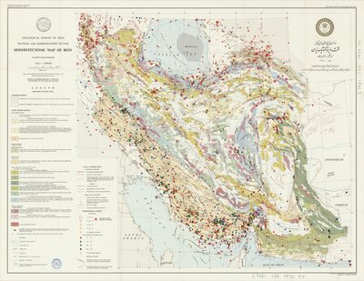
"Issued in commemoration of the 50th anniversary of the Pahlavi dynasty."
"Based on the modified Tectonic map of Iran (Stocklin and M. H. Nabavi, 1973) and other available information 1976."
Date:
1976.
Attribution:
Print map scanned from Olin Library Map Collection
Relief shown by shading.
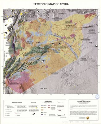
"Printed August 2001."
Accompanied by: Tectonic and geologic evolution of Syria (1 chart : col. ; sheet 79 x 64 cm.) and by text: Tectonic and geologic evolution of Syria / Graham Brew and Muawia Barazangi, Ahmad Khaled Al-Maleh and Tarif Sawaf (p. 573-616 : col. maps ; 30 cm.).
Originally issued as accompanying material (figures 15-16) to the text Tectonic and geologic evolution of Syria / Graham Brew and Muawia Barazangi, Ahmad Khaled Al-Maleh and Tarif Sawaf.
Reprinted from an article which originally appeared in v. 6, no. 4 (2001) of the periodical GeoArabia.
Date:
2001
Attribution:
Print map scanned from Olin Library Map Collection
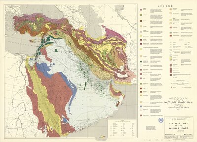
Added title in Arabic.
"This map was compiled from many sources ... The geographic base map was provided by Kümmerly & Frey, Switzerland. Project coordinator: Hans R. Grunau.
"Geology and hydrocarbon potential of the Middle East. Enclosure 10. March 1977."
Date:
1977. Print.
Attribution:
Print map scanned from Olin Library Map Collection
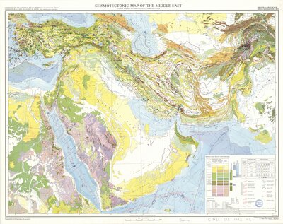
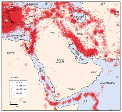
Fig. 4 from Geo-Information Systems for the Middle EastGeoArabia, Vol. 5, No. 2, 2000 Gulf PetroLink, Bahrain Design and Development of Information Systems for the Geosciences: An Application to the Middle East