John Wyatt Greenlee
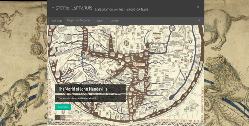
John Wyatt Greenlee earned his Ph.D. in Medieval Studies from Cornell in 2020. He was a fellow in the Graduate Summer Fellowship in Digital Humanities in 2015. During the 6-week fellowship, Greenlee began work on The Mapping Mandeville Project website, uniting Mandeville's book The Travels with an annotated, interactive map companion.
Project Title: The Mapping Mandeville Project

Project Statement:
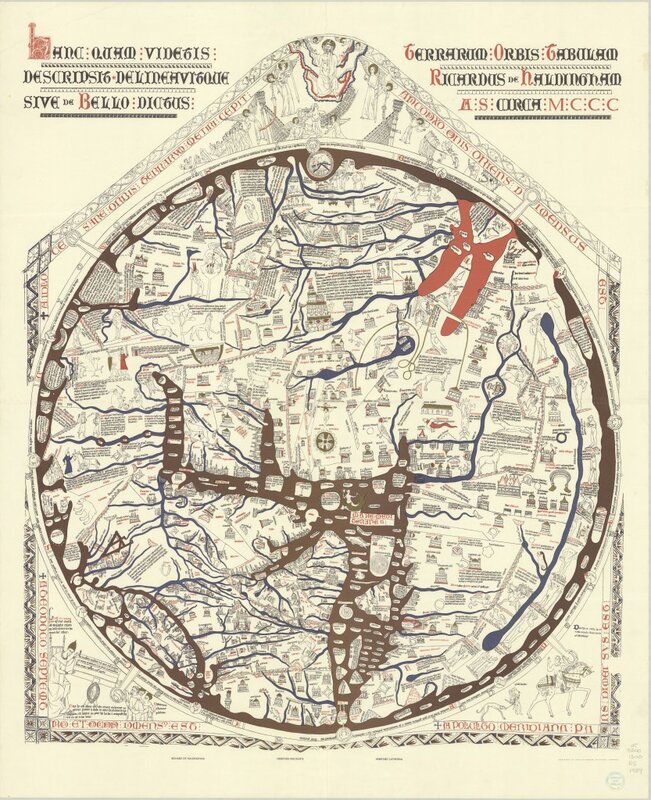
For this project, I have taken sections of text from the 14th century book, John Mandeville’s The Travels, and used them to annotate an interactive copy of the 13th century Hereford map. On their own, the book and the map can be difficult for students to approach. Students often attempt (and fail) to overlay the world that Mandeville describes onto a GIS-style map. The text does not describe a geography that accords with modern cartographic principals. Similarly, mappaemundi like the Hereford map can be intimidating. Not only is the language and the script difficult, but they are oriented differently than modern maps, and are less interested in accuracy than in issues of history and symbolic scale. My project proposes that the book and the map are better understood together. Clicking on icons on the map brings up relevant selections from the text, and so allows viewers to both understand Mandeville’s book within its proper framework, and to explore the foreign geographies of the map with a guide.
The Summer Digital Humanities Fellowship provided me with the impetus to begin this project, and the tools to complete it. The program introduced me to a wide range of platforms and approaches for digital scholarship and pedagogy. The later has been especially useful to me; introducing students to medieval worldviews can be a difficult proposition. Using projects like this one allows me to engage my students in multiple modes of learning, and to use medieval artifacts to help explain medieval perspectives.