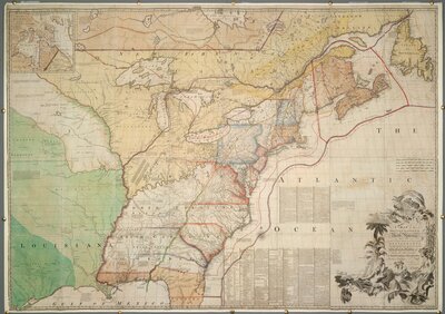
John Mitchell's map was the only map consulted during the negotiations preceding the Treaty of Paris in 1782-1783. Several editions of the map were annotated with boundary lines marked in red ink. In 1934, Col. Lawrence Martin, then chief of the Library of Congress Geography and Map Division, called Mitchell's map, "the most important map in American history." Manuscript annotations by J.E. Hawkins, draughtsman of the War Office certifying "that the boundaries transcript notes on this map are a true copy of those shown on the "Red Line" map in the British Museum. J.E. Hawkins, Intelligence Division War Office, 9th September 1898." This fourth edition published by William Faden with a new title reflecting the British defeat of the French and the annexation of Quebec.
Cartographer:
John Mitchell
Date:
1755
Attribution:
Accessed at https://collections.leventhalmap.org/search/commonwealth:hx11z549x
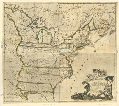
Reprint of the 1784 ed. published according to Act of the Connecticut Assembly, New Haven.
"Reproduced from the original in the Map Collection of the New Jersey Historical Society."
Issued with booklet: A new and correct map of the United States ... ([4] p. ; 26 cm.)