Mapping by, and of Native Peoples

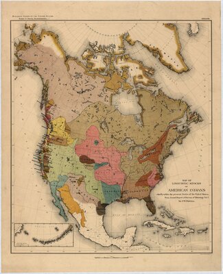
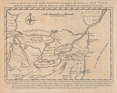
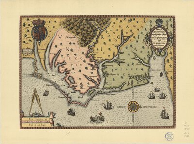
As visual interpretation of the built and natural landscape, maps provide insight into Euro-American understandings of Indian settlements and how those views changed over time. Surveying recent historiography and colonial cartography, Juliana Barr and Edward Countryman observe that Indian settlements figured significantly on Spanish and French colonial maps, which reflected empires that built economic and political arrangements dependent on knowing Indian communities. In contrast, they argue that mid-eighteenth-century British cartographers erased America’s Indian villages, which would remain missing from most American maps until the late nineteenth century. They contend that this erasure supported a broader British and, later, American effort to claim a continent by depicting it as a wilderness in need of settlers.
Anderson, Chad. “Rediscovering Native North America: Settlements, Maps, and Empires in the Eastern Woodlands.” Early American Studies: An Interdisciplinary Journal, vol. 14, no. 3, 2016, pp. 478–505. Crossref, doi:10.1353/eam.2016.0015. pg 480
![[Map of the several nations of Indians to the Northwest of South Carolina]. Catawba deerskin map](https://exhibits.library.cornell.edu/images/3242-50cb9a99320fadbb67b35d79ddbbb991/full/!400,400/0/default.jpg)
![[Maps of the Hudson Valley, Schoharie Creek and the Seneca Country]](https://exhibits.library.cornell.edu/images/3243-af0df99097530afb4e34ee57e1fd6beb/full/!400,400/0/default.jpg)