Skip to search
Skip to main content
Skip to first result
Cornell University
Cornell University
Library
Library
Online Exhibitions
Engaging Early American History through Mapping
HIST 2391 - From Terra Incognita to Territories of Nation-States
Home
Selected Maps
Maps in Early American Exploration
Mapping by, and of Native Peoples
Mapping the Early American Republic
Mapping the Continental Ambitions of the United States
Student Projects
About
search for
Search
Search
Home
Search results
Search
Search Constraints
Start Over
You searched for:
Exhibit Tags
Mapping the Continental Ambitions of the United States
✖
Remove constraint Exhibit Tags: Mapping the Continental Ambitions of the United States
1
-
2
of
2
Number of results to display per page
10
per page
per page
10
per page
25
per page
50
per page
100
per page
View results as:
List
List
Gallery
Gallery
Masonry
Masonry
Slideshow
Slideshow
Search Results
×
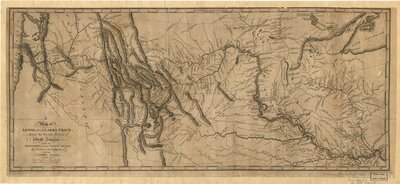
A map of Lewis and Clark’s track, across the western portion of North America from the Mississippi to the Pacific Ocean: by order of the executive of the United States
1 of 2
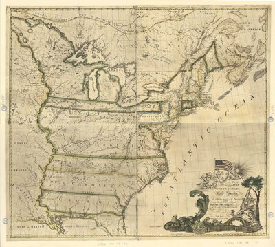
A New and Correct Map of the United States of North America: Layed down from the Latest Observations and Best Authorities Agreeable to the Peace of 1783.
2 of 2