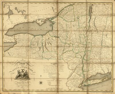
- Scale ca. 1:950,000.
- Hand colored.
- Relief shown pictorially.
- "Contracted from his large map of the state."
- Shows township boundaries.
- Includes index to "Towns" in Kings and Richmond counties.
Cartographer:
De Witt, Simeon
Date:
1804
Attribution:
Retrieved from the Library of Congress, <www.loc.gov/item/74696138/>.