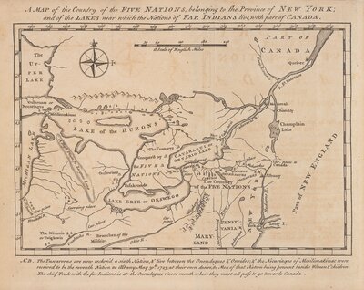
Manuscript maps of the Hudson Valley, land along Schoharie Creek, and the Seneca Country surrounding Seneca and Cayuga Lakes in what is now central New York. The Seneca Country map shows the location of Seneca villages at that time. Scale of the Hudson Valley map is 1:31,680; no scale given for the other two maps.
John R. Bleecker was a merchant, politican, and experienced surveyor and mapmaker in Albany.
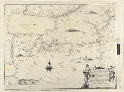
Title of Original map: A Mappe of Colonel Romers Voyage to Ye 5 Indian Nations: Going from New York to Albany Thence West ...
Reprint title used for the exhibit.
Originally drawn ca. 1700.
Oriented with north to the upper right.
Manuscript.
Photostatic copy.
Title in illustrative cartouche.
Includes ill.
"PSO/5285, K. top. CXXI 10."
Cartographer:
N/A
Date:
19? (reprint) 1700 (original)
Attribution:
Print map scanned from Olin Library Map Collection
![[Maps of the Hudson Valley, Schoharie Creek and the Seneca Country]](/images/3243/full/!400,400/0/default.jpg)